
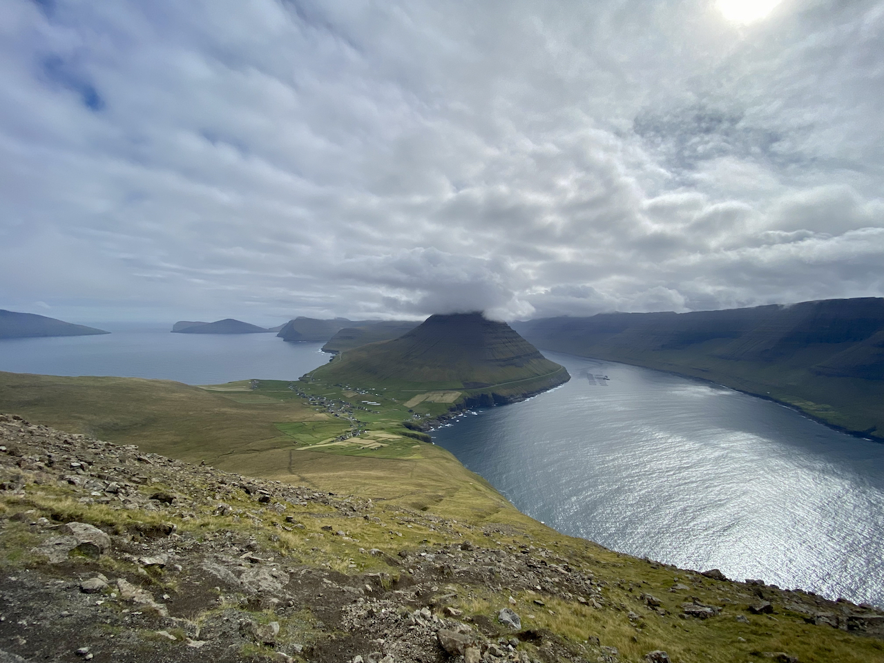
At the northernmost tip of the Faroe Islands lies a towering sea cliff by the name of Enniberg. Looming 754 m (2,474 ft) over the North Atlantic Ocean, it is said to be the world’s highest sea-facing promontory and, thanks to a thriving population of seabirds, has long been a magnet for ornithologists and boat-riding tourists alike. For those of a rambling persuasion, Cape Enniberg marks the turnaround point and scenic highlight of one of the Faroe Island’s most memorable hiking trails.
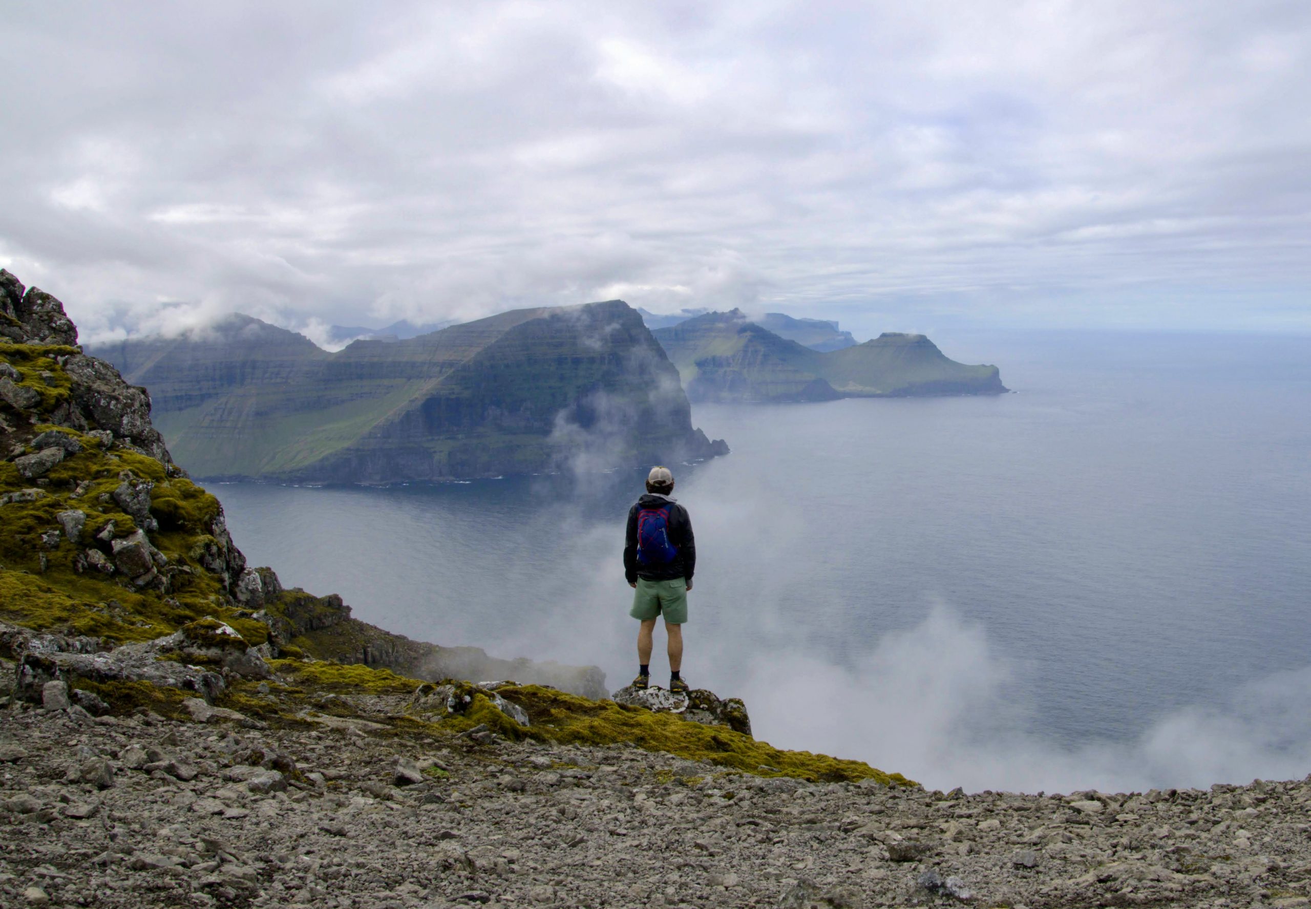
Yours truly gazing westwards from Cape Enniberg.
Note: The Cape Enniberg Trail was one of 26 featured hikes in my latest book with Gestalten Publications, Wanderlust Nordics. Much of the information below has been adapted from that publication. The book is already available in Europe and will be released in the US and other parts next month.
At a Glance
Distance: 7.7 km (4.8 mi)
Average Duration: 4-5 hrs
Difficulty Level: Moderate to challenging
Total Elevation Gain: 1,306 m (4,285 ft)
Start/Finish: Viðareiði, Viðoy Island
The rock-strewn slopes of Villingadalsfjal Peak (841 m/2,759 ft).
Planning Information:
- Getting There & Away: The nearest town to the village of Viðareiði is Klaksvik (20 minutes drive south). If you don’t have a car, you can hitchhike or take the #500 from Klaksvík to Viðareiði.
- Permits & Fees: No permits are required. At the time of writing, all hikers will need to pay a 200 DKK fee to the owners of the private property the trail passes through (Tip: You can leave the money in a mailbox near the trailhead gate)
- Bird Sanctuaries and Boat Rides: The cliffs of Cape Enniberg and its immediate coastal surrounds are a designated Important Bird and Biodiversity Area (IBA). Notable among its avifauna are colonies of Atlantic puffins, black-legged kittiwakes, European storm petrels, and black guillemots. If you’re interested in experiencing this dramatic coastal environment from a different perspective, consider taking one of the regular boat tours departing from the nearby port of Klaksvik.
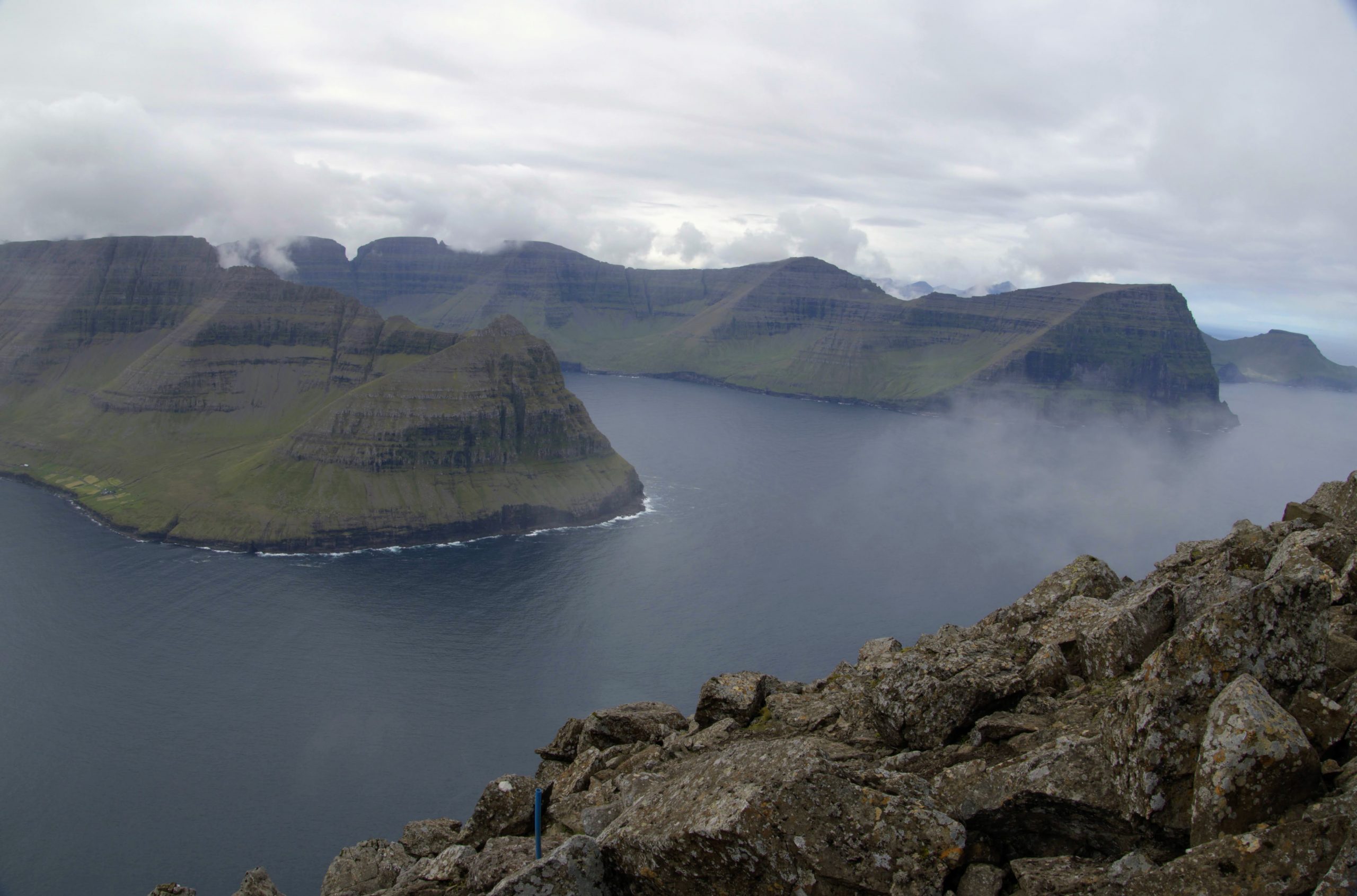
Views towards Kunoy Island on the way to the cape.
Trail Notes:
The Cape Enniberg Trail begins at Viðareiði village, the northernmost settlement in the Faroes archipelago. After paying your fee to pass through private property, go through a gate and ascend gradually up the grassy hillside. Following a well-defined path marked by blue plastic poles, after approximately 20 minutes of climbing, the grass gives way to rocky terrain.
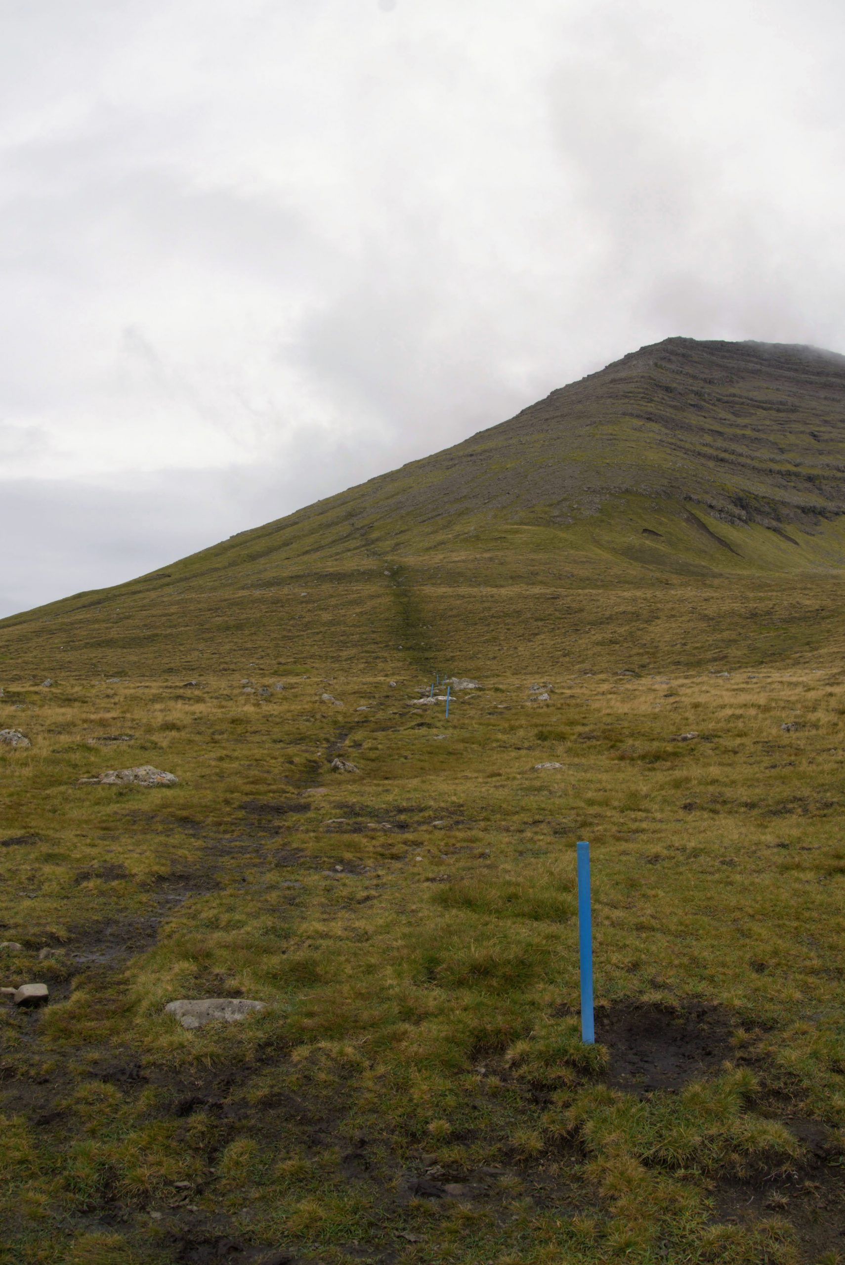
Heading up the grassy hillside at the start of the trail.
From this point, the trail becomes considerably steeper, and the tread appreciably looser. Winding your way up through the rock-strewn mountainside, around 100 m (328 ft) below the top of Villingadalsfjal Peak (841 m/2,759 ft), you’ll gain a small plateau. To the immediate northwest, a cairn-marked route continues to Cape Enniberg. The summit course continues northwards, and after a brief scramble, you’ll reach the apex of the third tallest mountain in the Faroes.
Looking back toward the village of Viðareiði and the pyramid-shaped Malinsfjall (750 m/2,461 ft).
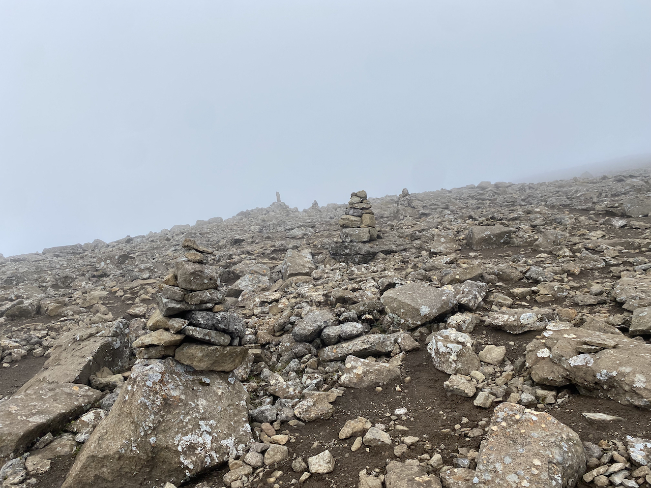
Following the cairns from the Villingadalsfjall junction to Cape Enniberg.
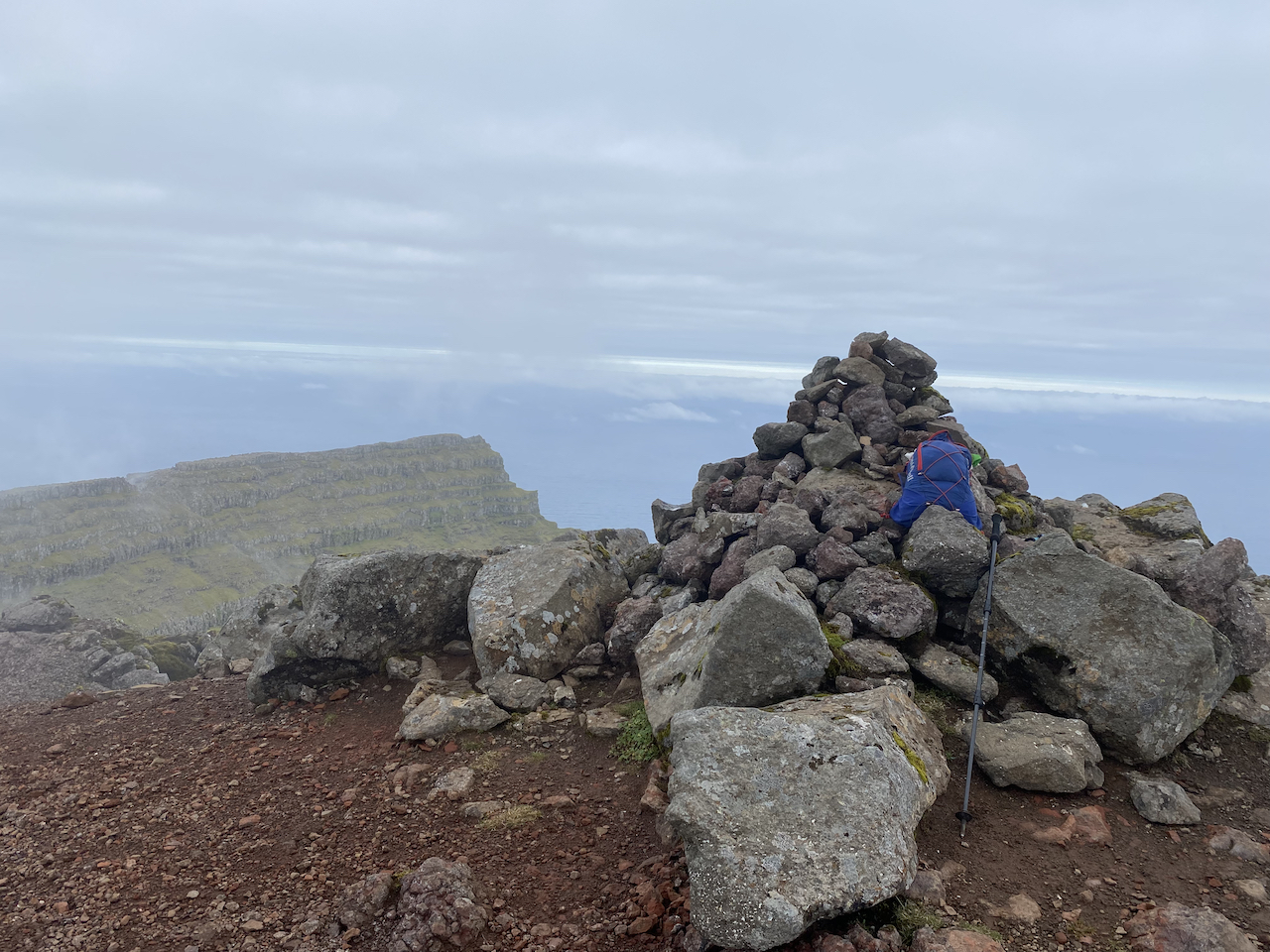
The summit of Villingadalsfjall (841 m/2,759 ft), the third highest mountain in the Faroe Islands (Note: The knife-edge ridge to Cape Enniberg can be seen in the background).
From the summit of Villingadalsfjal, retrace your steps back to the junction at the aforementioned flat area. From this point, follow the cairns northwest across the rock-strewn mountainside. In fine weather, it’s easy-going; in thick fog with driving wind and rain, a little less so. After approximately two kilometers, you’ll reach Cape Enniberg. When it’s time to return to civilization, retrace your steps back to the base of Villingadalsfjall and then follow the blue posts steeply down to Viðareiði.

Winged guardians and cliff-hugging trails.
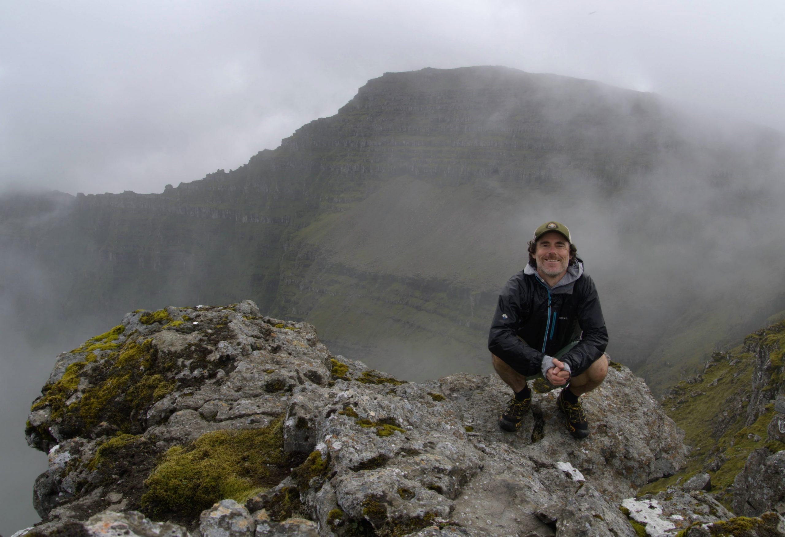
Yours truly at Cape Enniberg with the summit of Villingadalsfjall in the background.

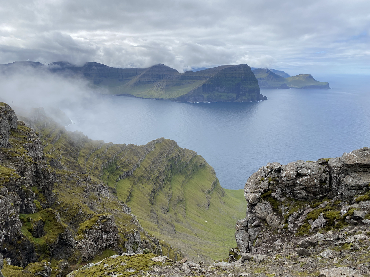
Gazing eastwards from the Cape.
Notes & Musings
- A Seaside Church and a Temporary Relocation: Either before or after your Cape Enniberg excursion, take some time to explore the charming trailhead village of Viðareiði. Established in the 14th century, foremost among Viðareiði’s attractions is its picturesque church. Located by the seashore on the western side of town, a former version of the building was destroyed by a massive storm in the 17th century. According to local folklore, numerous coffins from the church’s cemetery were washed out to sea during the tempest. In the following days, the caskets drifted back to land at the nearby village of Hvannasund. After discerning the origins of their unexpected visitors, the good folks of Hvannasund returned the missing caskets to their neighbors in Viðareiði, where they were promptly reburied.
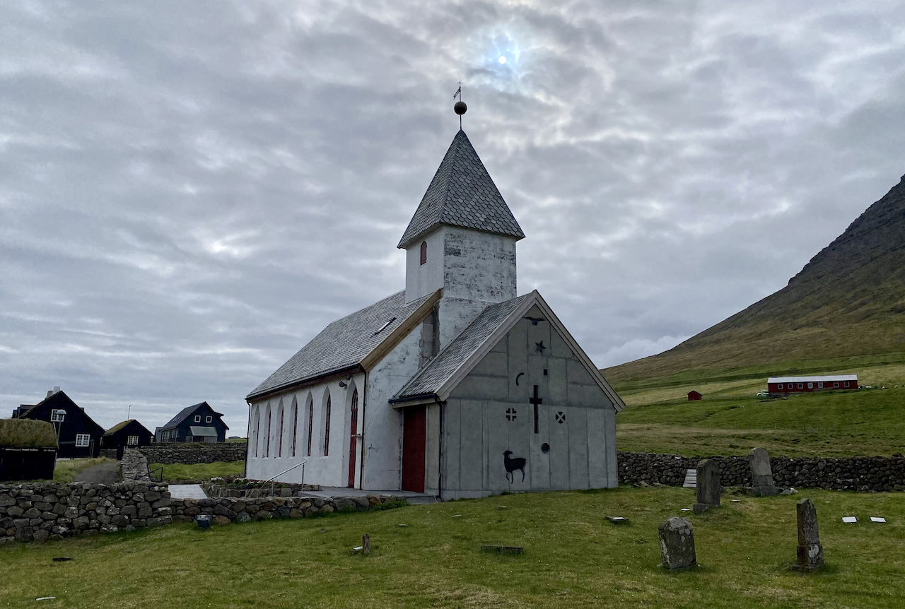
The storied church and graveyard of Viðareiði.
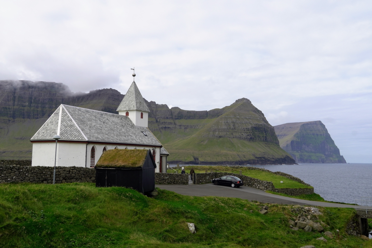
Viðareiði Church with the islands of Kunoy and Kalsoy in the background.
Related Posts