
South Shoal Pond Peak, also known as Twintop or Mt Quinn isn’t a popular destination in the Pemigewasset Wilderness. But I had a hankering to go climb it if only because it gave me an excuse to backpack out to the Thoreau Falls Trail, fly fish some rivers on the way, and camp along the North Fork of the Pemigewasset River. Of all the places I’ve hiked and backpacked in the White Mountain National Forest, this is one of my favorite areas.
Having finished my July grid peaks early in the month (climbing all 48 of the White Mountain 4000 footers in each calendar month), I’ve been enjoying a little “grid-cation” and catching up on some of my other favorite outdoor hobbies like backpacking, bushwhacking, and Tenkara fly fishing. While I enjoy doing each of these separately, I’ve also started combining them into multi-sport backpacking trips, where get to do all three. I’m loving these!
The Route (out and back – map above)
- Hancock Notch Trail
- Cedar Brook Trail
- Wilderness Trail
- Thoreau Falls Trail
South Shoal Pond Peak is a trailless mountain on the New Hampshire 500 highest list that I’ve been working through for a few years and hope to finish someday. The NH500 has quite a few bushwhacks on it and it’s a fun way to keep my off-trail navigation skills honed while traveling to all parts of New Hampshire, including areas outside of the White Mountains.
South Shoal Pond Peak is also located about 9 miles from the nearest road in the Pemigewasset Wilderness Area, so a backpack was in order to get there. I have a friend who did this bushwhack in a single day, but hiking 18 miles in a day and bushwhacking a peak, doesn’t really float my boat. However, I knew I’d enjoy backpacking out to the peak and hiking a few trails that I haven’t visited for a few years. Plus, there are three rivers along my route that I wanted to spend some time fishing including Cedar Brook, the East Branch of the Pemigewasset River, and the North Fork.
The Hanock Notch Trail leads to two 4000-footers, North and South Hancock, so it’s very heavily used. But after 2 miles, it reaches the Cedar Brook Trail which virtually no one uses and things take a turn for the wild. The trail climbs for a bit until it reaches the Wilderness Area boundary at height of land.
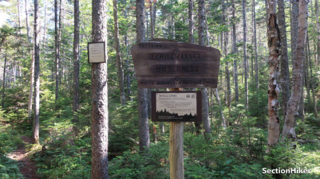
Height of land (HOL) is a navigational term used in the NorthEast to denote a watershed boundary and if you study maps in the White Mountain National Forest, you’ll see that a lot of the Wilderness Areas are bounded by these watersheds. The Native Americans used the same system to divide up their tribal lands.
Once you pass HOL, the Cedar Brook Trail gets wet with water flowing between the rocks and boulders in the path and boot-sucking mud as you descend gradually toward Cedar Brook. There have been some trail reroutes since I was here last and the trail now passes very close to the brook, which I don’t recall from previous visits. So I scrambled down a small embankment and crossed Cedar Brook to take a break and do a little Tenkara fly fishing.

While Cedar Brook is a smallish stream, it’s clear that it’s sustained heavy damage from past hurricanes and spring thaws, judging by the amount of debris, both rock, and wood, scattered along the banks. On my descent down the trail, I had spied massive rock formations upstream through the trees that I plan to go back and explore further. I think this spot will make a good destination all by itself or as a staging area for a bushwhack up North Hitchcock this September when I have another grid-cation coming up. I’ve seen a trip report from Zach Porter (a New Hampshire Triple Crown Finisher) where he describes a northern approach to that peak, which I may try.

I got back on the Cedar Brook Trail and followed it past the location of a logging camp, although there was very little debris evident from that era to be seen. On past trips through this area, I remember seeing many more rusting barrel hoops and sled runners, which is what you usually find at the old encampments. I followed the trail another mile or so to the Wilderness Trail junction and sat down for a spell to rehydrate. It was a very hot day with temperatures in the 90’s.
From there it was a quick walk to the Thoreau Falls Trail junction which leads down to the East Pemigewasset River and the site of a primitive log bridge that was recently removed. I hadn’t been there since the removal and wondered what they’d done with the timbers in the old bridge. This being a Wilderness Area, wheeled vehicles are prohibited, so there’s no way to remove the debris unless you carry them out on foot.

What I saw surprised me a bit. There were large sections of trees standing next to the old concrete bridge abutment. These, I surmised, must be the remains of the walkway from the old bridge, which I guess have been left to rot in situ.
This section of East Branch of the Pemigewasset River is quite narrow, which made it a good location for a bridge. Upstream from the old bridge site, there’s a nice stretch of rocks and drops that make good trout habitat. So I got my rod and fished this section, again quite successfully.

The day was waning, so it was time to head out and find a place to camp on the Thoreau Falls Trail. I forded the stream just below where the bridge used to run because it’s quite shallow there and headed down the trail which runs alongside the North Fork. I found a pre-existing campsite near Jumpin Brook, which comes down from Mt Bond and feeds into the North Fork, and set up camp. I planned to bushwhack the peak the next morning when temperatures would be cooler.

Once my tent was set up, I fished a while on the North Fork which was ice cold, ate dinner, hung a bear bag, and listened to a book (audible) for a while before going to sleep.
The next morning, I had breakfast, packed up, and headed north a mile or so to the point where I’d planned to start the bushwhack. I found a good place to enter the forest with a low understory, shot a bearing on my compass, and started climbing. The woods were largely open until I reached a set of cliffs guarding the west side of the summit. I followed the contour south to bypass them and climbed the summit from the south side.
South Shoal Pond Peak Bushwhack
I found the “canister” which was a glass jar containing a log book of previous visitors and signed in. Then switched direction and bushwhacked back down, taking a slightly different line, but rejoining the trail very close to where I’d started the climb. It’s important to remember that there are two halves to any bushwhack: the climb and the descent. You really need to be on your best game for both.

The day had started to heat up again, so I started retracing my steps from the day before since this was just an out-and-back route. I normally try to hike different trails on my return trips, but that would have added a day to my trip and I needed to get home. I took my time though and stopped for more fishing and water breaks, enjoying the return hike as much as I had the previous day.
I have one more week of grid-cation left and hope to do a similar Backpack-Bushwhack-Fly Fishing trip to another part of the forest I haven’t visited for a while in the Wild River Wilderness.