
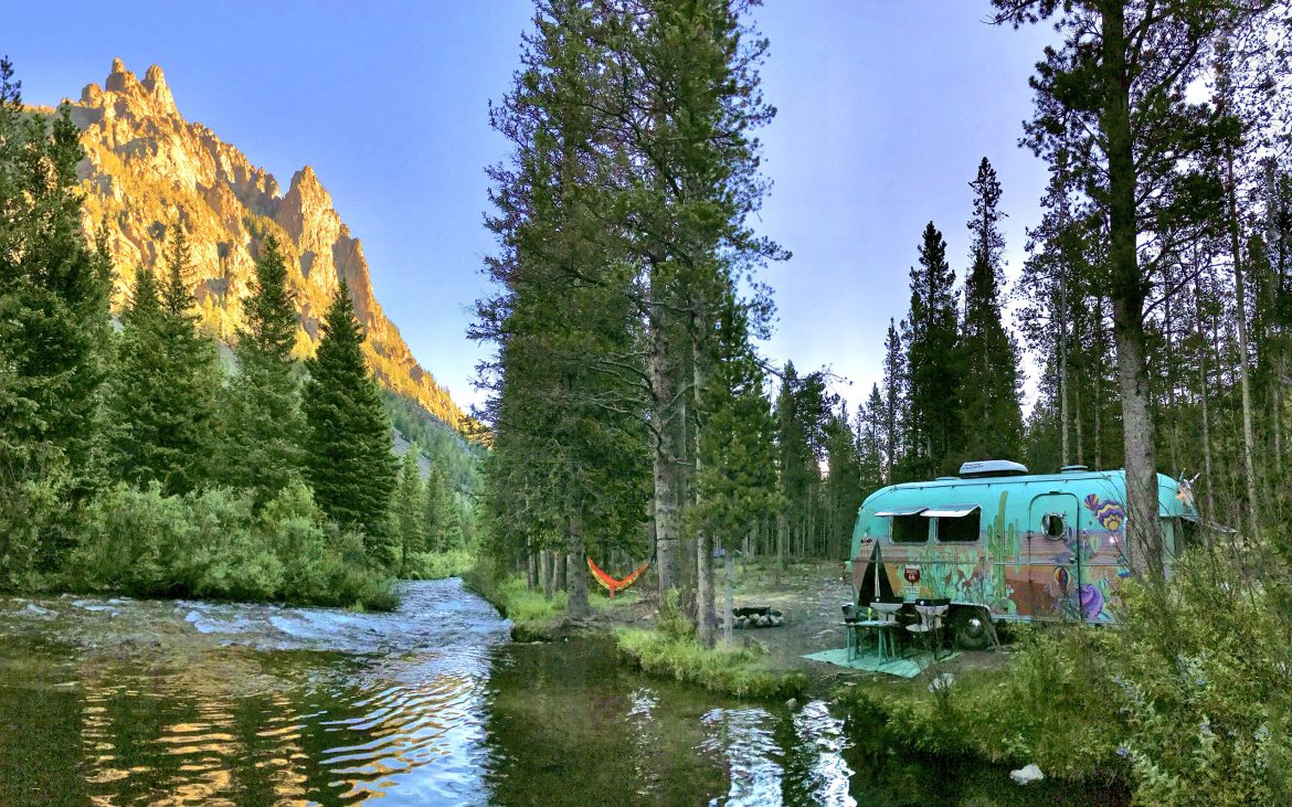
When it comes to exploring the outdoors, the sky’s the limit in Big Sky Country. Montana is undoubtedly one of the most breathtaking, pristine, and multi-faceted regions in the country. Being the largest landlocked state in the US, the Treasure State’s landscape encompasses desert, badlands, prairie, snow-capped mountains, and more than 8 million acres of national forest. Montana’s offerings are endless, from panoramic vistas, wild and scenic rivers, abundant wildlife, and Old West history. Visitors from around the world are drawn to its ancient glaciers and canyons, old-growth forests and nearly 100 different mountain ranges. Enjoy world-class fishing, Native American cultural sites, ghost towns, and dozens of hot springs throughout the state. Despite its global visitation, you’ll still find more cows than people in Montana — making it the ideal spot to plan an escape.
This spring, many parts of Montana received record rainfall, and places like North Yellowstone and Red Lodge suffered catastrophic flooding with a 1-in-500-year meteorological event. That said, now is the perfect time to plan your 2023 trip to the impacted areas or explore other parts of Montana in 2022.
Libby and the Kootenai River

The Kootenai Falls Swinging Bridge stretches high over the Kootenai Gorge.
Founded in the 1880s, Libby Montana can be found in the northwestern corner of the state along the Idaho panhandle border. Situated along the Kootenai River and flanked by the Cabinet Mountains, the town is in the heart of 2.2 million acres of national forest. Libby is home to over 140 lakes, 3 major rivers, and over 1,400 miles of trails- leaving plenty of opportunities to enjoy the great outdoors. While exploring this remote part of Montana, head to the famed Kootenai Falls and Swinging Bridge. Follow the 1.6-mile out-and-back trail to the suspension bridge, spanning 220 feet across Kootenai Gorge. Continue on to Kootenai Falls, one of the largest free-flowing waterfalls in the Pacific Northwest. Extending the entire length of the river, the vibrant turquoise falls dramatically cascade down the craggy rocks as it heads towards the gorge. If this scene looks familiar, that’s because it’s been a popular Hollywood filming site, including credits in The Revenant and The River Wild.

Kootenai River
Western Montana is also home to ancient forests reminiscent of California’s majestic Sequoias and Redwoods. From Libby, take the 37-mile drive to Ross Creek Cedars, a grove of 400-year-old cedars with diameters reaching 8 feet across. Take the short interpretive trail along the path where the towering giants loom 175 feet above Ross Creek. For a day of fishing or boating, follow the scenic byway to Lake Koocanusa, a 90-mile long body of water that straddles British Columbia and Montana and a great spot to catch rainbow and cutthroat trout.
Bighorn Canyon National Recreation Area

Bighorn Canyon National Recreation Area.
Located along the Montana and Wyoming border near the town of Fort Smith is one of the state’s best-kept secrets. The Bighorn Canyon National Recreation Area was established shortly after the construction of Yellowtail Dam and today stretches over 60 miles, 55 of which traverses through the canyon. This colorful chasm exposes more than 570 million years of Earth’s history, including sediments laid down by volcanic forces and inland seas. At its deepest point, the canyon rises 2,500ft above the floor at Bull Elk Ridge. This region of Montana offers an array of landscapes from snow-capped mountains, deserts, forests, prairie, and wetlands. Not only is the scenery diverse, but so is the wildlife. Here, you’ll have a chance to spot pronghorns, wild horses, bears, fox and the park’s namesake… bighorn sheep.
Additionally, the canyon is rich in indigenous history, with evidence of human activity dating back 12,000 years. During the winter months, these early people would travel deep into the canyon and live in caves and rock shelters. In the summer months, they followed the wildlife up into the mountains to hunt and escape the summer heat. The best place to see signs of these early inhabitants is along the Bad Pass Trail, where ancient cairns dot the sacred footpath. Today, Bighorn Canyon shares its land with the Crow Nation.
While exploring Bighorn National Recreation Area, it’s worth noting that the Montana and Wyoming entrances do not connect. However, both districts have their own unique offerings, so it’s absolutely worth visiting both. While Montana’s North Entrance is mostly water-based recreation, Wyoming’s Southern Entrance is largely land-based activities. Whether you decide to spend a day fishing and kayaking or hiking along the canyon rim, both districts are stunningly beautiful and are a great spot to escape the crowds.
Garnet Ghost Town

Garnet Ghost Town
If you love exploring ghost towns, do yourself a favor and visit Garnet, Montana.
Sitting around 6,000ft in elevation, this old mining town east of Missoula remains in a state of arrested decay and is one of the best-preserved ghost towns in the country. What started as a mining camp during the middle of the 19th century, Garnet peaked in 1890 with over 1,200 residents. Boasting 13 saloons, 3 hotels, and countless other businesses, this community was a happening place during the turn of the 20th century. What made this mining town unique was the fact that, unlike most Gold Rush boomtowns, this was a peaceful, family-friendly community. Throughout the town’s history, only one man (named Frank) was booked in its jail and gun fights and saloon brawls were nearly non-existent. Children went to school, families had picnics, and miners worked hard to provide for their families. Garnet’s luck faded after a devastating fire burned down half the town in 1912. Before long, the gold dried up, forcing miners and families to search for new prospects.

Inside a preserved building in Garnet.
Today, the area is operated by BLM and is $3/car or free for America the Beautiful pass holders. While visiting Garnet, explore the neighboring mining camp of Coloma just a few miles down the road. Though it’s not well preserved, there are a few remaining buildings as well as panoramic views of the mountains. The town is open year-round, and though the road is closed during winter and early spring, Garnet can be accessed via snowmobile or by cross-country skiing. The rest of the year, take the road from Bonner, as the road leading from Drummond is much rougher.
Beartooth Highway and Red Lodge

View from Beartooth Highway.
Nestled in the Beartooth Mountains near the Wyoming border and surrounded by Custer Gallatin National Forest, Red Lodge offers stunning scenery, interesting Old West history, and numerous opportunities for outdoor recreation. Like many boomtowns in the West, Red Lodge was built on mining. Within one year of the Rocky Fork Coal Company mine opening, more than 1,000 miners and families flocked to the community. By 1896, the town was teeming with action and between their 20 saloons, brawls and gunfights were commonplace. When the mining dried up during the Great Depression, members of the town urged Congress to build an “approach highway” to the neighboring National Parks — Yellowstone and Grand Teton. The bill was signed by President Hoover in 1931 and construction was completed in 1936; marking the dawn of the Beartooth Highway.

A view from the Beartooth Highway
Elevate your senses by taking the 68-mile jaw-dropping journey along one of the most scenic drives in North America. This winding mountain drive whisks you away to the heart of the Absoroka-Beartooth Mountain Wilderness, ascending to 10,947 feet in elevation. Known as the “Top of the World”, at the highest point along the highway, visitors are awarded panoramic views of the surrounding mountains. With over 20 peaks over 12,000ft, the drive passes glaciers, pristine lakes, cascading waterfalls, and vibrant displays of wildflowers during the summer months. Views you typically could only get by backpacking up into the mountains can be witnessed without even leaving a car. Don’t be surprised to see mountain goats and bighorn sheep grazing just off the highway, as wildlife is abundant in this region. Additionally, bears, marmots, elk, and wolves call these mountains home. Though it’s possible to do the entire drive in 3 hours, you can easily spend an entire day if not days exploring. With dozens of hiking trails, endless vista points, and several lakes to stop and have a picnic, there’s no better place to relax and take your time. Just be aware, freak snow storms even during the summer months is not unheard of, so check the weather forecast. Due to the winding road and steep grades, RVs are not advised so it’s best to leave the trailer at camp.
While visiting Red Lodge, stroll around their historic downtown, spend a day fishing on Wild Bill Lake, and drop by the Carbon County Historical Museum. Though the Beartooth Highway is closed in winter, the Red Lodge area offers year-round recreation opportunities including horseback riding, backpacking, golfing, and skiing at Red Lodge Mountain Resort.
Gardiner and North Yellowstone

Mammoth Hot Spring’s volcanic geology.
Gardiner is an Old-West style town and the gateway to North Yellowstone, the only year-round entrance to the national park accessible by car. With a population of less than 900 people, the quaint town of Gardiner is known for its fly shops, rafting outfitters, and western stores lining the streets. The town is situated in Paradise Valley along the banks of the Yellowstone River, and the perfect launching point for exploring Yellowstone. Pass through the iconic Roosevelt Arch, the first ever entrance to the national park, and explore North Yellowstone, which is much less crowded than its southern counterpart. While there, visit Mammoth Hot Springs, one of the most unique hot springs in the entire park. Unlike the majority of other thermal features in Yellowstone, this giant limestone formation looks like a cave turned-inside-out. Its travertine terraces are formed when the magma-heated water rises through the limestone, carrying with it high concentrations of dissolved calcium carbonate. At the surface, it forms deposits resembling chalky white rock, which continue to grow as long as this process continues. For a rustic but soothing soak, take a dip in the Boiling River where the hot springs meet the cold river water or plan a trip to the more commercialized Yellowstone Hot Springs Resort. For one of the best chances of spotting wildlife, head Southeast of Gardiner to the Lamar Valley. Dubbed the “American Serengeti” for its large and easy-to-see populations of large animals, this is one of the best opportunities to witness wolf packs, bison herds, grizzlies, and other wildlife that call Yellowstone home.
Glacier National Park

Saint Mary Lake is the second largest lake in Glacier National Park.
Last but not least, it wouldn’t be a proper trip to Montana without a visit to Glacier. Near the towns of Kalispell and White Fish, Glacier National Park is one of the most majestic parks in the Lower 48, showcasing vibrant wildflowers, carved valleys, ancient glaciers, and alpine meadows full of wildlife. The “Crown of the Continent” straddles the continental divide and covers more than 1 million acres, with 700 miles of hiking trails. Long before the park was established in 1910, it’s been the ancestral home to the Blackfeet, Salish, Kootenai, and Pend d’Oreille tribes for 10,000 years. Within the park boundaries, you’ll find 26 glaciers, 175 peaks, 762 lakes, 200 waterfalls, and 563 streams— leaving visitors endless places to explore. One of the best ways to venture the park is by taking the Going-to-the-Sun Road, a 50-mile scenic drive that winds its way across the park, offering jaw-dropping panoramic views of the mountains and river valleys. For movie buffs, this drive serves as the opening scene in The Shining as it makes its way to the fictional Overlook Hotel. While traversing the park, the road crests at Logan Pass, the park’s highest elevation reached by car. The pass sweeps visitors up to 6,646 and is famous for it’s late summer alpine meadows bursting with color as lupine, paintbrush, bear grass, fireweed, and lilies blanket the ground. The park’s symbol is the mountain goat, and it’s easy to see why. These regal creatures are known for scaling high and sheer cliffs and can be spotted along the road and trails. Other resident animals include moose, grizzlies, wolves, pikas, bighorn sheep, wolverines, and marmots.
Going-To-The-Sun Road

Tunnel in the Going-to-the-Sun Road.
Besides the park, there are plenty of other great activities in the region. For food, drinks, or shopping, head to Whitefish or Kalispell, where you’ll discover a bevy of bars, restaurants, and breweries. Nuzzled between two national forest, Whitefish is not only a great summer destination, but it’s a popular skiing destination with over 3,000 skiable acres, making it one of the largest resorts in North America. While visiting Kalispell, take a stroll through their historic downtown lined with building dating back to the late 1800’s, hike into Jewell basin, or kayak around Flathead Lake.
No matter where your travels take you in Montana, enjoy the epic outdoor adventures, Western hospitality, and unparalleled beauty!
All photos by Cate Battles.