
Looking into what hiking in Spain is all about? Look no further as in this article, I will share with you information on the best hikes in the region and how to go about planning them.
Let’s face it, when you think of Spain, hiking is probably the last thing that comes to mind. When traveling in a country filled with delectable food, wine that’s to die for, and vibrant cultural centers filled with world-famous works of art, making your way into the backcountry of Spain probably has never even occurred to you.
However, for some of the best views of the country, hiking in Spain is the way to go. Travel back in time with historic routes taken by pilgrims, traverse mountains with views all the way into France, and enjoy some adrenaline-filled adventures on walkways between mountains.
There’s truly nothing like hiking in Spain.
When it comes to planning your outdoor adventures, here are 10 of the best hikes to take on your trip to Spain!
While we’re in the topic of planning your adventure, I wanted to recommend checking out WayAway subscription which gives you access to a travel concierge plus cashbacks on hotels, flights, and activities!
1. The Camino de Santiago
Distance: 500 miles | Difficulty: Intermediate
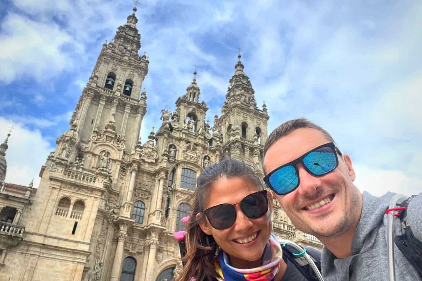
As the most famous trail in Spain and possibly the most well-known walking route in the world, the Camino de Santiago takes first place for best hikes in Spain. Whilst the walk itself is relatively easy as you can go in your own pace, the actual distance
This trek is a network of ancient pilgrim routes that span over 500 miles throughout Spain. The trails have been walked on now for more than 1,000 years, slowly switching from Christian pilgrims to eager travelers wishing to complete this epic journey.
The traditional routes all start at different places along the Spain-France border (the most popular one begins at Saint Jean Pied de Port) but all finish in Galicia at the Cathedral de Santiago de Compostela.
That being said, there are a ton of routes that start at different places throughout Spain, instead of only at the border. You can pick up the trail at any point along the seven well-established routes.
Alternatively, you can even link up with one of the six lesser-known routes which pass through places like Pamplona, Galicia, Asturias, and La Rioja.
Even if you aren’t ready to walk the full 500 miles to complete the entire pilgrimage, many people walk the Camino in bite-sized pieces or even just go for a single-day stroll!
We recently walked the Camino de Portuguese (from Porto to Santiago de Compostela) and absolutely loved it.
In order to get the pilgrims certificate, you need to prove you’ve walked the last 100km by getting stamps in your pilgrims passport which you procure before hand.
The trails are flat and well-maintained, making for an easy walk, and pass through some gorgeous scenery. However, this walk is much more about the history of the trail than the actual nature it passes through.
Walking on Camino trails is a super social experience. You’ll pass through local villages, meet other hikers making their way to Galicia, and learn about those who walked the trail hundreds of years before you.
It’s a great way to immerse yourself in Spanish history while filling your lungs with fresh air!
Getting There: The Camino stretches a full 500 miles, so unless you want to start at the very beginning, you can link up with the trail throughout different parts of Spain.
If you’re traveling by air, flying into the Basque Airport is the closest to get to the start of the trail in St. Pied de Port, which is roughly 50 kilometers away. Otherwise, you can make your way to St. Pied de Port from Madrid via Renfe train or Alsa bus to Pamplona. From Pamplona, you can take a second bus to the start.
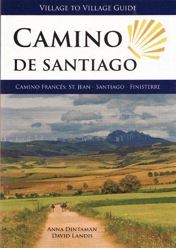
Note: If you wanted to walk the entire trail or even take a multi-day trek along it, it’s best to plan your route accordingly. There are a lot of information online when it comes to walking the Camino de Santiago. This guidebook can be an incredible resource to help you plan!
✨The 1 Thing We Never Leave Home Without…✨

Coming from someone who has been traveling the world for the last 8 years AND has been in the hospital 2x, travel insurance is something everyone NEEDS to get. Get a quote below!
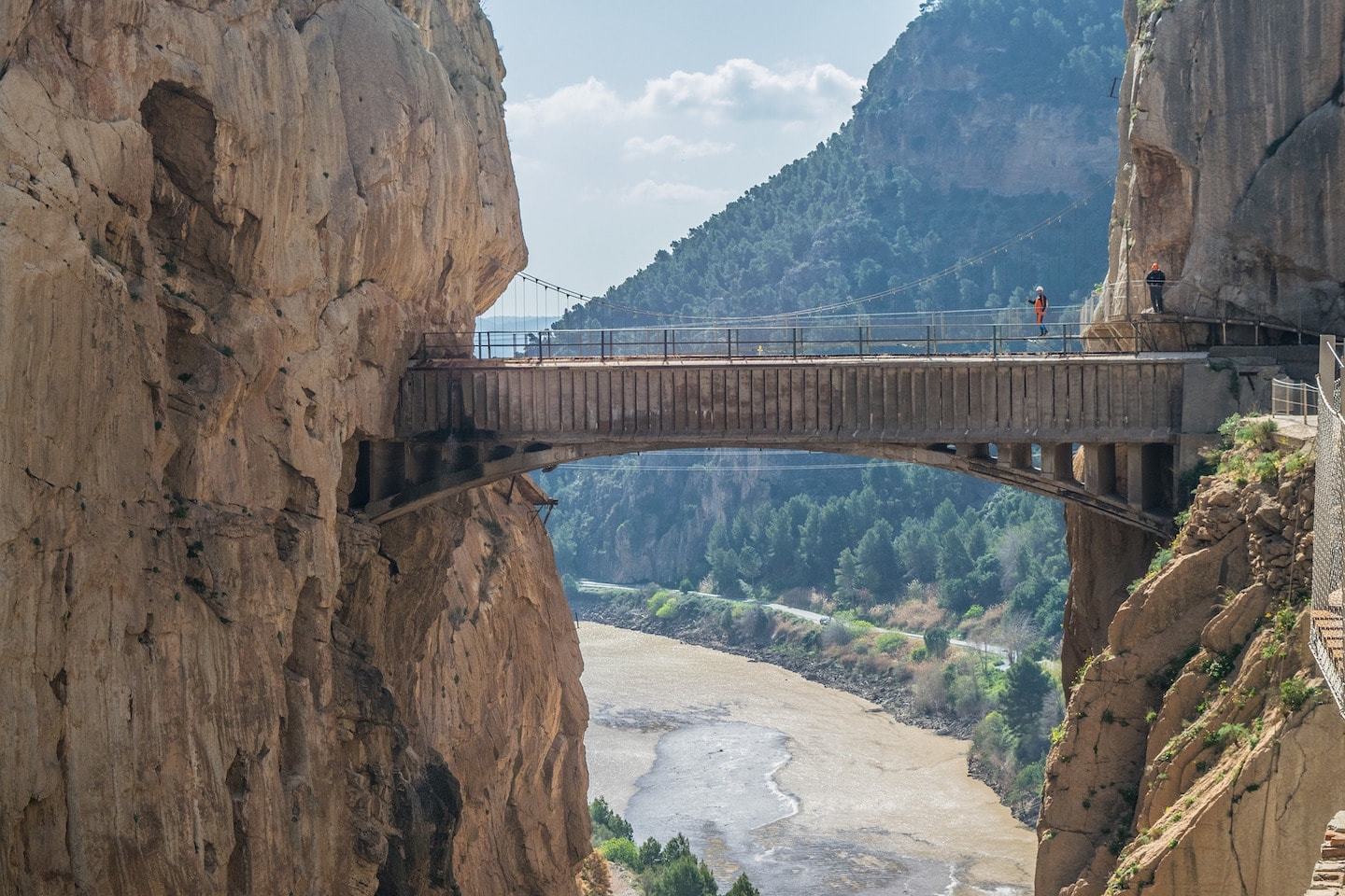
2. Caminito del Rey
Distance: 5 miles | Difficulty: Medium
Tour Recommendation: Guided day tour from Malaga
Once known as one of the most dangerous hiking trails in the world, the Caminito del Rey was a hike for serious thrill-seekers ready for an adventure. While the trail has gotten some much-needed safety updates in recent years, it still remains an insane trek with spectacular views.
This five-mile trail travels from Ardales to Alora. It takes about four hours to complete, as you walk along paths carved into the sides of steep, steep cliffs. You’ll be faced with stunning views of rocky mountains, rushing streams, and lush greenery as you traverse precarious pathways and cross-hanging bridges.
Just keep in mind that the path is open every day from Tuesday to Sunday. It is closed every Monday, January 1st, December 24th, 25th and 31st!
Getting There: Getting to the Caminito del Rey is fairly easy, if you’re coming from Malaga. If you wish to take the train, Renfe regional trains service El Chorro village on a daily basis. From the village, you can take a shuttle bus which will drop you off at the northern entrance of the trail.
Want to know more about what this hike is like?
Check out our guide to Caminito del Rey!
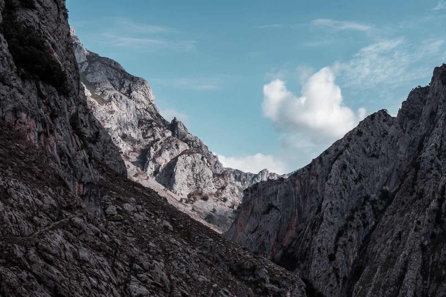
3. Picos de Europa
Distance: 7.5 miles | Difficulty: Intermediate – Hard
While you can spend several days hiking through the Picos de Europa, if you’re looking for a taste of Spanish wilderness, hop on the Ruta del Cares trail for a 12-kilometer route through some of the most beautiful parts of the National Park.
The trail runs from the village of Poncebos in Asturias to Caín in Leon, and is essentially carved out of the sides of the surrounding rock formations. It passes across bridges and crosses streams, all the while giving you stellar views of Spanish peaks.
It’s no wonder that this trail is also known as “The Divine Gorge” because it certainly provides some of the most divine views in all of Spain!
Getting There: The best way to get to Picos de Europa is by driving, as the surrounding scenery is absolutely astounding. There are lots of small towns on the way that are well worth stopping in as you travel to the park, so you can make a real trip out of this journey!
Alternatively, you can take a bus to Arrondas and Unquera from large cities like Madrid and Barcelona. Taking a bus is a good option, especially in summer as the roads are closed to cars and by bus is the only way to get through the park.
You can also take a train into Oviedo or Santander from anywhere in Spain, but you’re still left with a decent distance to travel to get to the park. Once arriving at the station, you can easily hop in a cab and make it to the park, and then the trailhead.
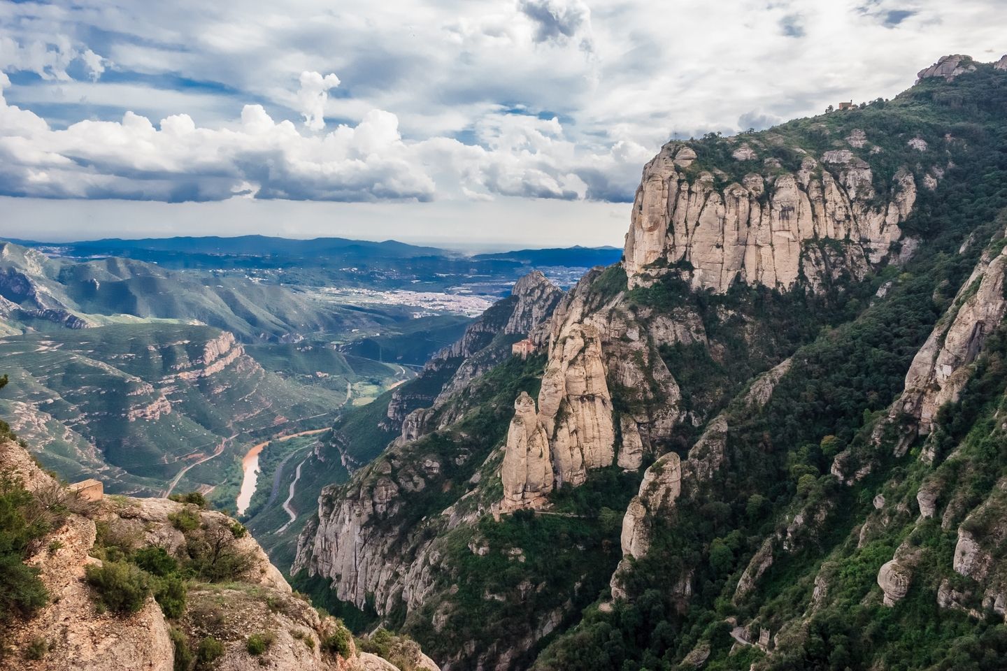
4. Montserrat
Distance: Varies with route | Difficulty: Easy – Medium
Tour Recommendation: Montserrat Monestary Visit + Farmhouse Lunch
Easily accessible from Barcelona and one of the most popular destinations in the region, a trip to Montserrat is a must if you’re in the area. This is one of the best places to hike across a jagged mountain range, with unbelievable views of countryside, the winding trails below, and good old Spanish nature.
Monserrat is one of the best things to do in Barcelona and is an activity we highly recommend.
Besides being an absolutely stunning place to experience Spain’s wild side, Montserrat is also a special place in the Catholic religion. The mountain houses a Black Madonna statue, as well as a Benedictine monastery. It’s also a place where many people made a pilgrimage towards a better life.
One of the trails you can take is the one from the base of the mountain up to the monastery. As you walk along the rocky trails up to the monastery, you’ll be able to experience more than just nature in all of its glory. You’ll be able to imagine all of those who walked here before you!
Alternatively, you can take the cable car or rack railway up the mountain and explore the trails higher up.
If it’s breathtaking views that you’re after, the best trail to take is Sant Jeroni which will take you to the top of the mountain. For this route, you start off by taking the Funicular at the monastery to Sant Joan, from which you’ll walk the rest of the way to the highest point on the mountain.
If height isn’t what you’re after on your Montserrat hike, there are plenty of trails from the monastery that will take you to interesting sites along the way without bringing you to the top of the mountain.
One of the most popular routes is a walk from the monastery to Santa Cova, an important pilgrim site where the Virgin Mary was believed to have been seen. Alternatively, you can walk from the monastery to The Degotalls, which will give you a gorgeous view of the Pyrenees and the flat lands making up the Llobregat valley.
No matter which route you choose in Montserrat, you’re bound to be amazed!
Getting There: The best way to get to Montserrat is to start in Barcelona. It’s a 54-kilometer journey, and most people take the train. You can take the R5 train from Placa Espanya in Barcelona to Monistrol de Montserrat. It takes about an hour and a half, and when you arrive you can easily walk right to the trailhead that takes you up to the monastery.
Another option is to stop at Aeri de Montserrat and take the cable car up to the monastery. From there, you can move on to the other hiking trails that lead up to the top of the mountain and other sites around the monastery.
5. Pico Sobarcal Trail
Distance: 8.5 miles | Difficulty: Moderate – Extremely Hard
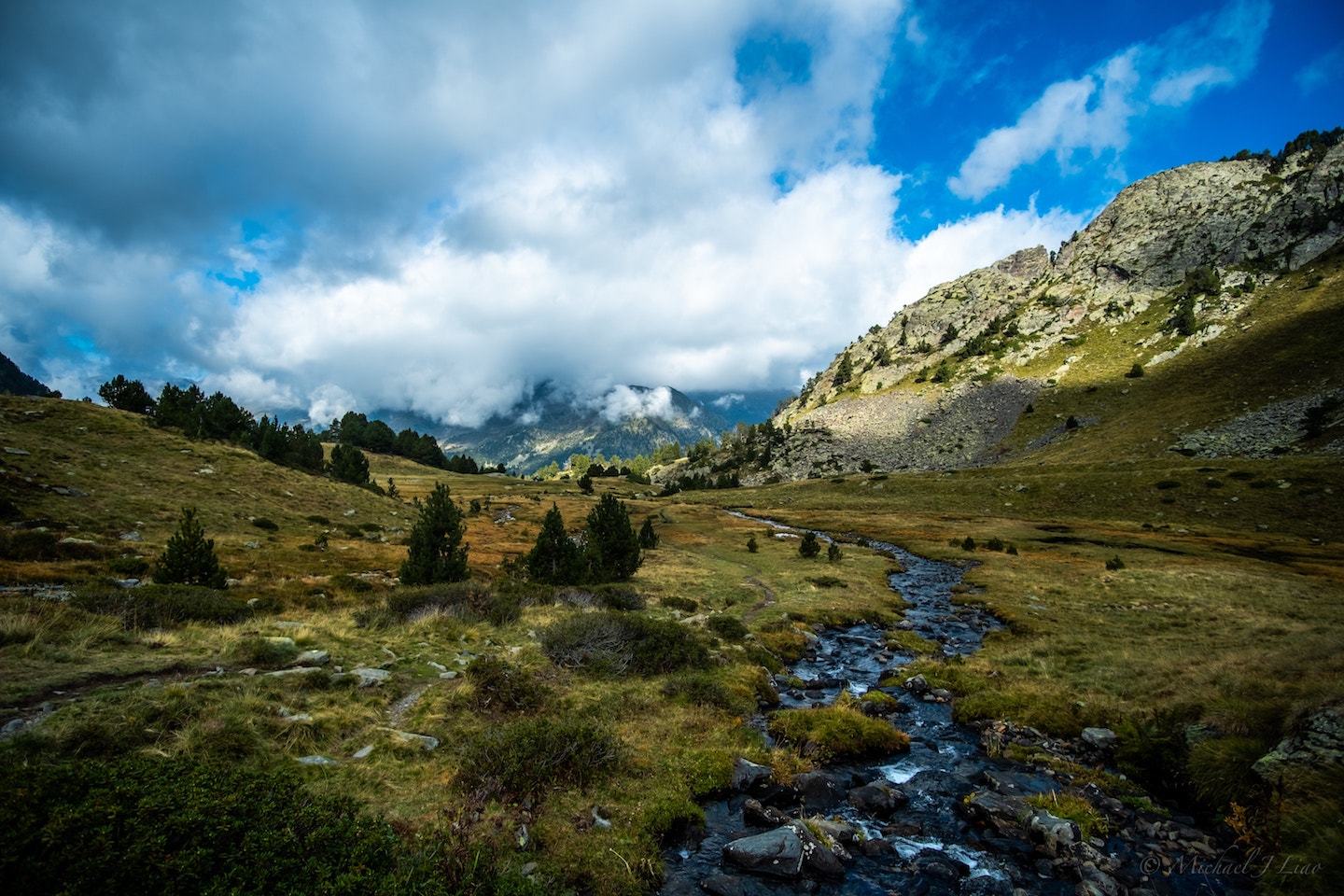
Creating a natural border between France and Spain, there’s no more stunning sight than the Pyrenees Mountains in all of their glory. One look at these tremendous mountains and you feel as if they’re calling to you. So what better way to enjoy them than to hike!
The Pico Sobarcal trail is a long and moderately challenging hike to a summit of 2,259 meters. From the top, you’ll have absolutely insane views of the mountains all around you, as well as the world just below. If you look far enough, you’ll even be able to peek into France!
It takes seven hours to reach the summit on this trail, and it’s not too too difficult most of the way up. However, as you approach the summit, it gets much more challenging, so be sure that you’re adequately prepared!
The peak should only be reached by those who have advanced mountaineering skills as it’s quite treacherous, but if you are one of these people, it simply cannot be missed.
Getting There: To get to this hike, basically you’re going to want to aim towards France. The easiest way to get there is by driving as there aren’t many buses or trains that service the mountainous area or get you close enough to the trailhead.
From Navarre, you’re going to want to drive through Isaba to get to Zuriza, where the trailhead is located. There’s a parking lot at the end of the road, which is also where the hike starts so you can comfortably leave your car and hop right on the trail.
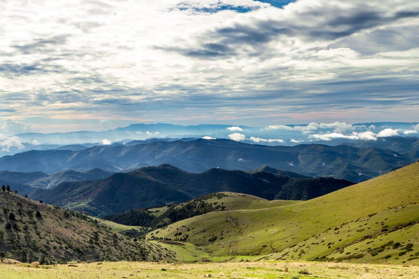
6. Cami dels Bons Homes
Distance: 124 miles | Difficulty: Medium
The Cami dels Bons Homes, which translates to “the Path of the Good Men”, follows the path the Cathars used as they fled from the Spanish Inquisition in the 13th century. The trail begins way down in southern France but then travels up through the Pyrenees to a final destination in Catalonia.
This is no short hike, and just walking from the Spanish side takes a whopping five days to complete in full. It’s certainly challenging and shouldn’t be taken on by inexperienced hikers. But there are plenty of parts of the trail that are suitable as day treks for those in the area looking to get a taste of the famed route.
The route is broken up into different stages, many of which are too long to be hiked in a single day, but trekking part of them is a great way to get bite-sized pieces of this massive trail.
One great route to take in Spain is Stage two from Gosol to Baga, which takes you through small towns and villages with insane views of the Pyrenees. While the entire stage takes about six hours to hike, you can always stop when you feel like you’ve had enough.
The views on this hike are nothing short of majestic. You’ll walk through completely empty meadows where you’re surrounded by nothing but grass and greenery. Then you’ll plunge into deep, dark forest and cross expansive valleys.
You’ll even pass through the occasional ancient ruin along the way, so it will be easy to imagine yourself as a Cathar, taking this trip so many centuries ago.
Getting There: Getting to the route depends on where you’re starting from. If you are departing from the beginning of the trail on the Spanish side, you’ll have to get yourself to Berga. Berga sits just north of Barcelona, and you can reach it by Alsa bus. It takes 2 hours and once you arrive, you’ll be ready to hit the trail!
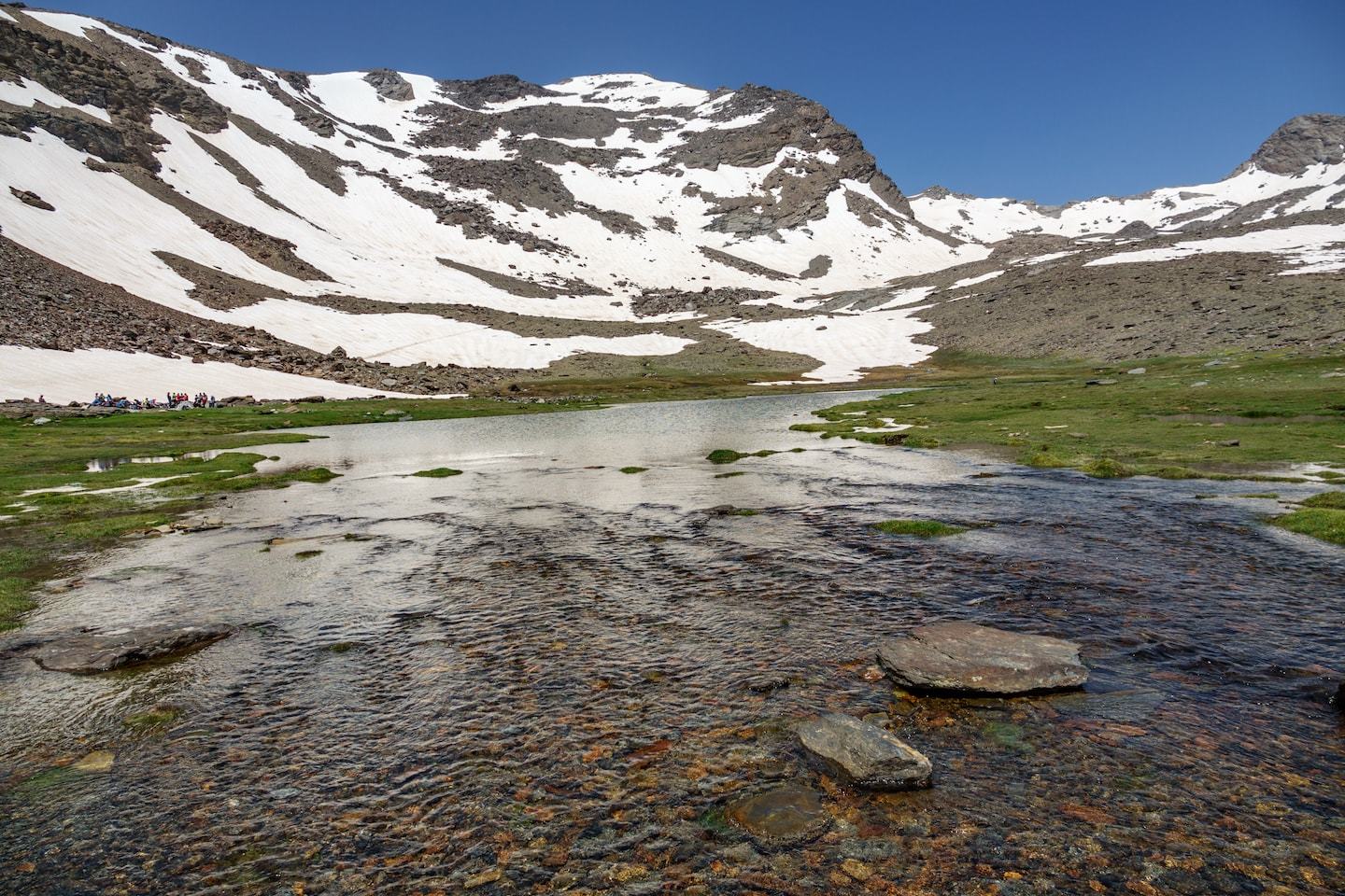
7. The Mulhacen
Distance: Varies with route | Difficulty: Easy – Extremely Hard
For views to last a lifetime, head to the Sierra Nevadas to hike up the highest mountain on mainland Spain. The Mulhacen is right near Granada and is nearly 3,500 meters high! It’s a great summer hike for those wishing to stretch their legs and it can be done in a single day, which is ideal for eager travelers.
There are several trails that reach the summit of this mountain, all ranging in difficulty and length.
The easiest, and most popular, trail traverses up the southern face of the mountain from Mirador de Trevelez in the Alpujarras, and only takes two hours to reach the top. The hike is so short because for the first part, you’ll travel by bus until you reach 2,700 meters, from which you’ll complete the hike to the summit. Just note that this service is only available during the summer!
There are two other trails that travel up the southern side of the mountain that are also moderate in difficulty, so there’s something for every kind of hiker here.
Alternatively, if you’re an experienced mountaineer and are looking to flex your skills, opt for the northern face which is the most challenging way to reach the summit.
Getting There: To get to the trailhead of the easiest trail, you have to take a special bus as we’ve mentioned above. This bus runs from Capileira to Paraje del Cascajar, from which you will continue your hike.
To get to Capileira, it’s an easy drive from Granada, or you can take a bus run by Alsa services. Busses leave four times a day from Granada and takes two and a half hours.
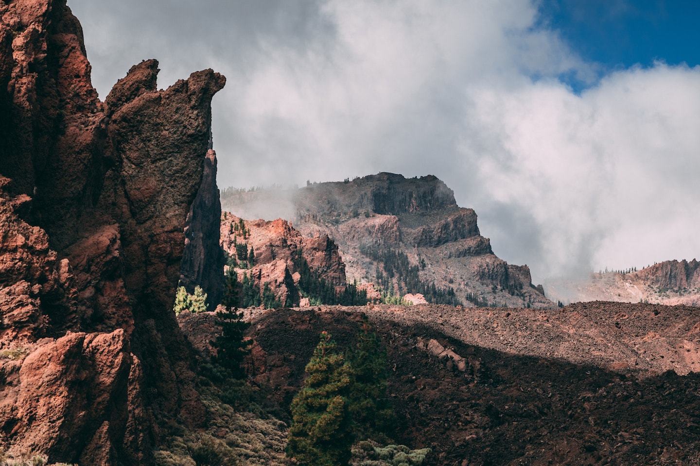
8. Las Canadas del Teide National Park
Distance: Varies with trail | Difficulty: Easy – Intermediate
Tour Recommendation: Guided tour of Mount Teide
So, I mentioned that The Mulhacen is the tallest mountain on mainland Spain but what if you move to the islands?
Resting peacefully on the island of Tenerife, you’ll find Spain’s tallest mountain, Mount Teide, coming in at a graceful 3,718 meters. The ginormous mountain is located in Las Canadas del Teide National Park, meaning that there’s nothing around but pure nature.
The park itself is an outstanding place for viewing volcanic landscapes and stretching your legs on the numerous hiking trails throughout the protected area. You’ll find all trails suitable for all levels of hikers here, so it’s a great place to explore if you’re visiting the island, no matter your skill level!
Mount Teide can be hiked on a visit to the park, and those who brave the altitude will be rewarded with insane views of an 80-meter crater that’s only visible from the top. It’s free to hike, but you must apply for a permit beforehand if you’re visiting during summer, and you need to have a guide with you as you approach the peak.
Getting There: The park is easy to get to by car as it’s off the main highway, TF-21. Otherwise, there are two bus routes. Bus number 348 runs from Puerto de la Cruz to the park, as does bus 342 from Playa de las Americas.
An easy option is to choose a guided tour of Mount Teide which includes a cable car ascent and a one-hour hike to the summit. With permits and round-trip transportation taken care of, this is a convenient way to experience the beauty of Mount Teide!
9. Camino de Ronda (GR92)
Distance: 137 miles | Difficulty: Easy – Hard
For sheer coastal views filled with sprawling ocean on one side and dense greenery on the other, head to Costa Brava to walk the Camino de Ronda, also known as GR92.
This trek begins right on the Spanish side of the Spain-France border in Portbou and travels all the way to the south to Uldecona. Yes, this is another long walk, but like with the other expansive trails found in Spain, it can be done in bite-sized pieces rather than all at once.
GR92 is split up into 20 different stages to give travelers the choice of where, when, and how long they’d like to walk for. Some stages are just quick day hikes while others are trips that take several days.
Walking the entire trail takes ten days, but is totally worth it to see all of the fishing villages, hidden beaches, and stunning coves along the way.
Where you walk greatly determines the scenery but it’s said that the most beautiful parts of the route are near the National Park of Aiguamolls de l’Emporda and in the south between Bergur and Palafrugell.
Just remember to pack your bathing suit and a towel because there are plenty of beaches along the way for some relaxation when you get tired of walking!
Getting There: Getting to GR92 depends on where you want to start. If you want to begin in Aiguamolls de l’Emporda, there’s a public transit station located right at the entrance of the park. Bus lines 101 and 400 service the park, and it’s easily accessible from Girona.

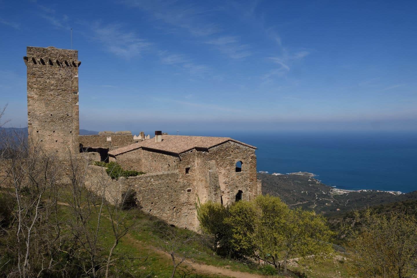
10. Cami de Rodes
Distance: 2.25 miles | Difficulty: Easy – Medium
For a short, sweet, and only slightly difficult hike to round out your Spain trip, make your way to Sant Pere de Rodes, a Benedictine monastery sitting 500 meters above sea level overlooking the Cap de Creus peninsula.
There are tons of walking trails that take eager visitors up to the monastery, and it’s fairly easy to get to this point. However, the real treat lies just above the monastery: the remains of the Sant Salvador de Verdera fortress.
After reaching Sant Pere de Rodes, follow the uphill path to the fortress. It takes about 30 minutes of walking uphill on rugged rocks to reach the prime spot. but once you make it to the fortress, you’ll be treated to panoramic views of the natural park that lies below.
While this may be a short hike, it’s impossibly beautiful as the entire time you’ll be able to catch sight of the Pyrenees mountains capped with snow as well as the Mediterranean Sea, expansive and deep turquoise. What more could you ask for on a hike through Spain?
Getting There: Accessing the monastery couldn’t be easier, just as long as you have your own transport. It’s a quick drive from the center of Vilajuiga and Port de la Selva (the nearest towns), and there’s plenty of parking available. There are also walking trails if you prefer to make your way up by foot or don’t have access to a car, but the trailheads are between three to five miles from town.
Once you reach the monastery, there’s a well-marked path that will lead you to the towering fortress above.

Hiking in Spain Gear Recommendations
Keep in mind that preparation for hiking in Spain is absolutely essential.
The terrain may be rocky or technical, requiring proper footwear, and water sources along the trails tend to be scarce so a water bottle or two is vital. If you’re planning on embarking on one of the longer treks, make sure you have suitable equipment for camping and keeping yourself warm on the cooler Spanish nights.
Getting Around Spain
Hopefully, you’ve found one or two hikes that you have now added to your list. With that in mind, all that is left is how to get around! Spain is very well connected via high speed trains but our top recommendation is always to rent a car.
With so many hikes to choose from, it’s hard to know where to start. But the good news is all hiking in Spain is exciting and oftentimes combines culture, history, and outdoor adventures into one action-packed trip.
So which hike in Spain are you off to first? Let us know in the comments below and remember to stay safe out there. Happy hiking!
Looking for more adventures in Spain? Check out these articles
Inspired? Pin It!
