
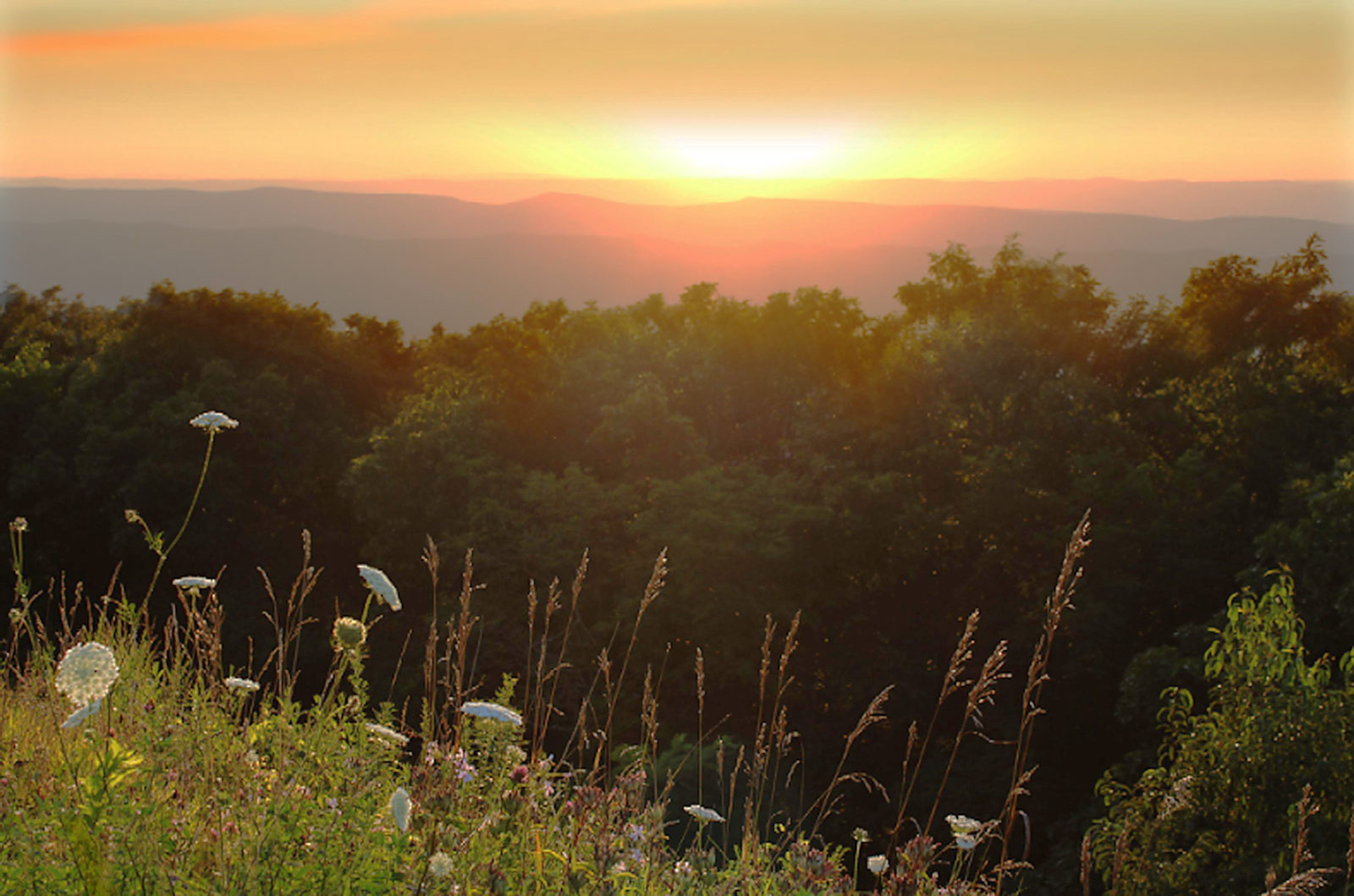
The US has some incredible national parks, and Shenandoah National Park is one of them. Just a 1.5-hour drive from Washington DC, Shenandoah has over 200,000 acres of wildlife and spectacular scenery. The park extends across Virginia’s Blue Ridge Mountains, with the famous Skyline Drive cutting through the middle. Shenandoah National Park has tons of wildlife, including black bears. It also has dramatic mountains, and Old Rag Mountain and Hawksbill Mountain offer some of the best hikes in Shenandoah.
What are the best hikes in Shenandoah National Park besides summit hikes, though? Shenandoah has over 500 miles of hiking trails to explore, so you are not short of options.
Top Hikes in Shenandoah National Park
From waterfall hikes to rock climbing, we’ve picked the absolute best hikes in Shenandoah National Park. These hiking trails are sure to get you feeling inspired.
1. Mill Prong Trail

Mill Prong is a scenic, pretty woodland hike. Hikers are surrounded by wildflowers like mountain laurels and shaded by the trees around them. The trail also runs along Mill Prong River, and you’ll cross over the river via multiple footbridges throughout the hike. A return hike takes around two hours, and Mill Prong is an out-and-back trail.
So, why should you hike this trail? Well, its Rapidan Camp’s endpoint was once the holiday home of President Herbert Hoover and First Lady Lou Henry Hoover. The couple spent many a happy time in the woodland camp, and now you can view the camp as a historical attraction. There are three cabins in total, with one signposted as the Prime Minister’s and informative signs dotted around with stories and facts about the camp and how Hoover spent his time there.

The trail starts opposite Milam Gap Parking Lot, situated along Skyline Drive. You briefly join the Appalachian Trail before nearly immediately turning left onto the blue-marked Mill Prong Trail. After following the riverside path for a little while, you make the first river crossing, after which you keep right on the yellow marked Mill Prong Horse Trail. From this point, you stick to the trail until you reach Rapidan Camp.
Mill Prong is a fantastic hike of moderate difficulty. The trail distance is just 3.7 miles return, short enough for families or less fit hikers to tackle. If you fall into these categories, just allow an extra hour or two to complete the hike.
Explore More US National Parks
Ready for some quickfire facts? These are the statistics that you should know
- Trail distance: 3.7 miles
- Difficulty: Moderate
- Elevation gain: 223 meters
- Trailhead: Milam Gap Parking Lot
2. Rose River Loop Trail

Rose River Loop Trail is another beautiful riverside hike. However, unlike Mill Prong, this route hops along different waterfalls. The dramatic endpoint is Rose River Falls – one of Shenandoah’s most famous waterfalls. Hikers can enjoy the Rose River Trail at a sedate pace, as the moderate hike is just 3.8 miles long on a loop trail. You should allow around two hours to complete the entire hike.
Rose River Falls is a stunning 67-foot waterfall, hidden away in woodland and only accessible via the loop trail. After following Rose River for most of the route, reaching the massive waterfall is an appreciated reward. Some people choose to swim in the waterfalls plunge pool, and you’ll probably be easily persuaded on a warm day. Either way, pack a picnic and plan to sit for a while for a break next to the falls.

Rose River Loop Trail sits opposite Fishers Gap parking area, which is located on Skyline Drive. Once you’ve parked, cross the road and head straight down the fire track, aka Rose River Fire Road. After a few minutes, you reach a yellow marked lefthand turn off for the Skyland Big Meadows Horse Trail. Taking this turn, you continue for just over half a mile before spotting the blue-marked Rose River Trail. It is here that the adventure begins, and you have countless cascades waiting for you along this route section – including Rose River Falls itself.
Rose River Trail is a beautiful moderate hike of just 3.8 miles. The round trip is easily tackled in half a day, so it is perfect if you are short on time but want a rewarding hiking experience. Bring your hiking boots and a swimming costume, and you’ll have a fantastic time.
Statistics about this hike:
- Trail distance: 4 miles
- Difficulty: Moderate
- Elevation gain: 267 meters
- Trailhead: Fishers Gap Overlook Car Park
3. Dark Hollow Falls Trail

Dark Hollow Falls Trail is one of the most stunning waterfall hikes in Shenandoah National Park – especially in spring when mountain laurel dots the trail with pink and autumn when the leaves turn yellow. The 70ft Dark Hollow Falls is one of the most famous attractions in Shenandoah National Park. The waterfall’s trail is somewhat of a local icon in the hiking scene.
The name ‘Dark Hollow Falls Trail’ makes it sound quite gothic. It is true that the river stays in the shadows for much of the day. However, this is much more exaggerated in autumn and winter. During these months, the low lighting is perfect for long-exposure photography. It cuts a beautiful contrast against the wet rock and autumnal leaves. Dark Hollow Falls is an atmospheric, scenic short hike.

Dark Hollow Falls Trailhead is in the parking area, which sits at mile 50.7 on Skyline Drive. Park up and head to the north end of the parking area. You’ll access the trailhead, crossing a stream and heading downhill alongside the Hogcamp Branch River. After around half a mile, you’ll emerge at Dark Hollow Falls, and you can spend a moment admiring the 70ft waterfall up close.
Walking to Dark Hollow Falls is perfect if you struggle with directions. The out and back trail is one route down and one route back – straightforward and simple for a relaxing short stroll. Apart from the uphill return hike, the track is undemanding and suited to beginners. Remember that it can be slippery in wet months and that venturing off the trail can be risky because of all the hidden drops.
Hiking details that you should know:
- Trail distance: 1.4 miles
- Difficulty: Moderate
- Elevation gain: 172 meters
- Trailhead: Dark Hollow Falls Parking Area
4. Upper Hawksbill Trail

Are you more of a panorama person than a waterfall lover? Take our advice and climb one of Shanandoah’s mountains. Hawksbill Mountain is one of the best hikes for beautiful viewpoints in Shenandoah National Park. It has stunning views over the surrounding mountains and Shenandoah Valley. Upper Hawksbill Trail is an exciting summit hike, yet it only takes around an hour to complete a round trip. The Hawksbill summit hike is short and sweet – packing a punch into a 2.1-mile trail.
So, you are probably wondering how difficult tackling Hawksbill Mountain really is. The route is a bit of a mixture and has some challenging hike sections, but it is an easy trail for the most part. The only tricky part is in the last quarter of the hike, where the path becomes steep, rocky terrain that you must pick your way through carefully. Wear sturdy hiking boots, and you’ll be absolutely fine. It helps that the trail distance is low, and the elevation gain is relatively gradual.

Park up at the Upper Hawksbill parking lot and head straight to the blue-marked Upper Hawksbill Trailhead. The initial section is a wide path that weaves through dense woodland. You then head slightly downhill to intersect Hawksbill Fire Road and join the road for the final climb to the summit. This section is the most challenging underfoot, with rocky terrain to navigate.
The National Parks Service maintains the trail well, but you should be prepared for this section to be a little more rough and ready than the other sections. Walkers emerge triumphantly at the summit and are met with sweeping views of Shenandoah Valley, Old Rag Mountain, and Betty’s Rock. If you are feeling ambitious, you can try time reaching the summit with the sunrise for the ultimate views.
Tackling the Hawksbill summit is excellent if you want a hike that will give you a strong sense of accomplishment. The route is also nice and short – perfect for squeezing into a busy itinerary. Did we mention that Hawksbill Mountain summit is the highest point in the national park? Completing this hike is quite an achievement.
Hiking details that you should know:
- Trail distance: 2.1 miles
- Difficulty: Moderate
- Elevation gain: 149 meters
- Trailhead: Upper Hawksbill Trailhead
5. Bearfence Mountain Trail

Bearfence Mountain might not be as big as Hawksbill, but the peak still has impressive summit views. You can reach the summit via the Bearfence Mountain Trail – an intense, single-mile trail incorporating a rock scramble. Bearfence Mountain Trail is an exciting hike for those who want an adventure and good views.
While not technically challenging, you will need to be happy to try new things and get stuck in if you are a beginner. Rock scrambles require patience, confidence, and a positive attitude. But if you can tick those qualities off, you’ll have a great hike. Scrambling up Bearfence Mountain is perfect if you want a memorable adventure in Shenandoah National Park.

Start your hike by parking in Bearfence Mountain Parking Lot, just off Skyline Drive. You then cross Skyline Drive to the trailhead opposite the parking lot to begin the walk. Bearfence Mountain Trail quickly changes terrain from a steep slope to rock scrambles. From a navigational perspective, it is an easy hike since you just keep heading up towards the summit. Be prepared to feel out of breath, but the climb is so short that you will manage as long as you have a basic fitness level. You’ll be richly rewarded, too, as the summit has 360-degree views over the national park.
Bearfence Mountain might not be the tallest, but it is the most fun. No other trail in Shenandoah National Park has the same unique structure as Bearfence Mountain Trail. The rock scramble is perfect for adventurous beginners and intermediate hikers.
Hiking details that you should know:
- Trail distance: 1 mile
- Difficulty: Moderate
- Elevation gain: 74 meters
- Trailhead: Bearfence Mountain Parking Lot
6. Stony Man Trail

Fancy an easy hike? The Stony Man Trail is the one for you. It is one of the best hikes in Shenandoah National Park and is just 1.5 miles long. Even better? The trail has minimal and gradual elevation gain, yet some of the best views in the national park. Stony Man is a hike that rewards you for essentially the bare minimum.

So, let’s take a look at the route. You start your hike at the Stony Man Parking Area, joining the Appalachian Trail briefly before turning off on the blue-marked Stony Man Trail. The trail here is straightforward, and you soon reach the Stony Man Viewpoint. The Stony Man Viewpoint is a little rocky outcrop overlooking the valley. Usually, there is a tiny rainwater pool at the summit. After appreciating the view, you just retrace your steps to the parking lot since it is an out-and-back trail.
Stony Man Trail is fantastic. And, if you want a short walk, it is easily one of your best options. Stony Man is a match made in heaven for hiking beginners with the impressive summit viewpoint, clearly marked path, and short trail distance.
Hiking details that you should know:
- Trail distance: 1.5 miles
- Difficulty: Easy
- Elevation gain: 97 meters
- Trailhead: Stony Man Parking Area
7. Cedar Run Falls Trail

Cedar Run Falls Trail is a challenging waterfall hike that requires around five hours to complete. It is best to allocate a whole day to this hike, as it is easy to get distracted by the many waterfalls and natural swimming pools dotted along the out-and-back trail. Cedar Run Falls Trail is a fun, longer hike suitable for those wanting a challenge or whole-day activity.
Many hikers use the trail’s famous natural water slide and challenge themselves to some popular cliff jumps. You may wish to pack swimwear to join in (at your own risk). It is worth noting that Cedar Run Trail has experienced some closures over recent years. Check the National Park Service website before visiting to check if the trail is open and welcoming visitors.

Start your hike at Hawksbill Gap Parking Area. Soon you cross a footbridge across Cedar Run River, and from this point, you follow the river and spot waterfalls along the way. Once you pass the first few waterfalls, the route gets very steep and slippery, so you’ll need excellent footwear. Cedar Run Cascade is near the endpoint and worth reaching if possible.
So, should you choose Cedar Run Falls? Yes, if you want a strenuous hike that will push you to your limits. The walk best suits experienced hikers with good technical ability, fitness, and hiking gear. That said, though, the route is full of natural attractions and very entertaining to hike.
Hiking details that you should know:
- Trail distance: 5.8 miles
- Difficulty: Challenging
- Elevation gain: 685 meters
- Trailhead: Hawksbill Gap Parking Area
8. Appalachian Trail

Now the Appalachian Trail is no walk in the park. The trail actually stretches through multiple states, Virginia being one of them. If you wanted to complete the whole trail, you’d need between five and seven months! However, you can complete Shenandoah’s section of the Appalachian Trail in less than sixty hours. If you love multi-day hikes and have a strong sense of adventure, tackling this section of the trail is one of the best hikes in Shenandoah National Park.
The trail has many shelters along the way. You can use them for overnight camping and filling up water bottles at freshwater taps. You’ll visit many of the attractions from our other top hikes on this list – including Stony Man and Loft Mountain (which we will cover shortly). Hiking Shenandoah’s Appalachian Trail is a fantastic way to combine lots of different attractions in one experience.

If you are hiking the Shenandoah section, the trail starts at Dickey Ridge Trailhead in the north of the park. You cut through the national park, passing attractions like Swift Run Overlook, Turk Mountain Overlook, and Sawmill Run Overlook before reaching your final waypoint at Beagle Gap. We recommend purchasing a physical copy of a trail map rather than a digital one, especially since this is such a long-distance hike.
The Appalachian Trail is the ultimate hike in Shenandoah National Park. Hikers will need to be determined, fit, and healthy.
Hiking details that you should know:
- Trail distance: 115.5 miles
- Difficulty: Challenging
- Elevation gain: 6,939 meters
- Trailhead: Dickey Ridge Trailhead
9. Lewis Spring Falls Trail

It is no secret; Shenandoah National Park is full of spectacular waterfalls. Lewis Spring Falls Trail is one of the best waterfall hikes in Shenandoah National Park. Towering 81 feet high, Lewis Falls is the crowning jewel of the trail – and the fourth tallest waterfall in the national park. The track is relaxing to hike and has picnic areas dotted along the way. If you want a hike that you can amble along leisurely, Lewis Spring Falls is the one for you.

The trail starts at the parking lot and immediately takes you into woodland. Turn left at the first trail marker and then right at the blue-marked track, continuing through dense forest and past many small waterfalls. At the trail endpoint, you’ll reach a large observation deck, and it is here that you’ll find the best views of the main waterfall – Lewis Falls.
Keep your eyes out for wildlife as you hike. There are deer and bears to spot, plus lots of beautiful flora, especially in spring. Lewis Spring Falls Trail is a great hike to immerse yourself in nature.
Hiking details that you should know:
- Trail distance: 3.5 miles
- Difficulty: Moderate
- Elevation gain: 267 meters
- Trailhead: Milepost 51.2 in the Big Meadows Area
10. South River Falls Trail

South River Falls is another celebrity on Shenandoah’s waterfall scene. The 83-foot waterfall is a real sight to behold, and if you love natural attractions, this trail is a high-reward route to tackle. You’ll follow beautiful riverside trails and complete one stream crossing – finishing at the viewpoint.
The trail is just 2.4 miles in length and takes around an hour and a half to complete. The out-and-back route is the perfect morning hike and is easily squeezed into a busy itinerary. South River Falls is a great candidate if you want a short walk to complete as a stretch of your legs after a strenuous hike the day before.

The trailhead is a blue-marked trail south of the South River Picnic Area. Navigating a hiking trail has never been easier. Just ignore any turn-offs and stay on South River Falls Trail until you reach the viewpoint.
This trail is absolutely beginner friendly. Easy to navigate, short, and enjoyable, South River Falls Trail is an ideal route to stretch your legs and enjoy the sunshine.
Hiking details that you should know:
- Trail distance: 2.4 miles
- Difficulty: Moderate
- Elevation gain: 230 meters
- Trailhead: South River Picnic Area
11. Loft Mountain Loop Trail (via Frazier Discovery Trail)

Loft Mountain Loop Trail is another short hike for your itinerary. The trail is in a handy loop and is a breeze to complete at just 2 miles in length – suitable for even the most inexperienced hiker. The track has a stunning viewpoint on its descent section and quiet, peaceful woodland paths.

So, let’s dive straight into some directions. Starting at Loft Mountain Wayside, join the paved trail on the opposite side of the road. Almost immediately, you reach a fork in the path, and from here, turn left on the blue-marked Frazier Discovery Trail. Keep left and begin your uphill walk, turning left at the second concrete trail marker that you see. At this point, you’ll start descending, and it is this section that you need to keep your eyes out for the ‘endpoint’ view. The view is gorgeous – overlooking the national park, surrounding mountains, and woodland.
Continue on the loop to get back, keeping left to stay on the blue marked Blue Spring Trail. Eventually, the trail turns into a fire road, and you’ll turn left when it intersects with Skyline Drive to reach your starting point, Loft Mountain Wayside.
Loft Mountain is one of the best hikes in Shenandoah National Park if you want an easy loop trail. Sure, it requires a bit of navigating, but the track itself is brilliantly untechnical, and the trail length is nice and short at only 2 miles long.
Hiking details that you should know:
- Trail distance: 2 miles
- Difficulty: Moderate
- Elevation gain: 151 meters
- Trailhead: Loft Mountain Wayside
12. Whiteoak Canyon Trail

Whiteoak Canyon is our final hike and comprises a beautiful selection of cascades and waterfalls. Whiteoak Canyon is an excellent option if you are the sort of hiker who loves having lots to see. You have waterfall after waterfall and countless plunge pools for swimming. Whiteoak Canyon is the sort of dreamy hike you take in your summer holidays.
The main reason for marking Whiteoak Canyon as a moderate hike is its trail length. The trail takes over five hours to complete, so you’ll need a good level of fitness and stamina. Additionally, the track can become slippery and narrow in sections. The spray from waterfalls and fallen leaves becomes a tricky combination when finding sure footing, so bring strong footwear with a good grip. Otherwise, Whiteoak Canyon Trail is straightforward and untechnical.

Starting at the Whiteoak Canyon Parking Area, you immediately take the Whiteoak Canyon Trail. Follow the path along the riverside, pausing at scenic spots as you wish along the way. The endpoint is a rocky ledge; from here, you can take a stunning view of the Upper Falls. If you want, you can also make your way down to the plunge pool at the base of the Upper Falls, which is popular for swimming.
Whiteoak Canyon Trail is one of Shenandoah’s most popular hikes for many good reasons. It is fun, relatively challenging, and has plenty of things to see along the way.
Hiking details that you should know:
- Trail distance: 9.5 miles
- Difficulty: Moderate
- Elevation gain: 734 meters
- Trailhead: Whiteoak Canyon Parking Area
Final Thoughts
Are you ready to tackle these best hikes in Shenandoah National Park? Shenandoah Valley is one of the most beautiful places in Virginia, if not the US as a whole. You should definitely add it to your list of the best places to visit in the US. You’ll have the pleasure of enjoying some of the best hikes in the country.
We hope you have found your match amongst all these excellent hiking trails. Whether you choose a short hike or tackle a strenuous trail like the Appalachian Trail, admiring the rolling hills of Shenandoah National Park will be memorable.